Otter abundance in the area of Dačice

One of the actions of the Czech National Otter Management Plan is a population surveillance and mapping. Estimation of otter abundance in selected core areas, serves for obtaining of various information. These are otter population density, abundance, structure and development of the population trend in these areas. The regularly updated information about population density will also be used as one of the source documents for calculating damage caused by the otter.

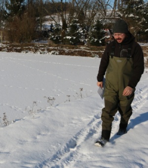
This year, area of Dačicko, which represents highland fishpond area occupied by south Bohemian sub-population has been selected base on snow condition and weather forecast. One square (10x10 km) representing a typical otter habitat in the area was snow-tracked by several trackers within a single day, counting all otter tracks from previous night.
We found tracks of 11 animals including one mother with a cub. This is comparable to results from previous years, when we recorded 8-14 animals and 1-3 families in average. The results confirm that highest otter population densities are found in traditionally fishpond areas, to which Dačice area and all Czech-Moravian Highland belong.


